

The original, 100+-year-old Palm and Pine Tree Duo in the middle of Highway 99 in Madera will be replaced. Here’s where to look on Google Maps.
Driving South on Highway 99 from Bakersfield concluding a week-long Vegas trip, I noticed a Palm sticking out in the center median near Madera.
I then remembered there’s a famous tree duo, a Palm and Pine, symbolizing the division between Northern and Southern California.
According to Central Valley native Steve Newvine, the arboreal duo has been in the center median of Highway 99 since at least the 1920s. Accounts from at least one local farmer claim the pair was there long before the highway was built (Highway 99 was built in 1926).
Here’s a bit of history about the famous California trees.
But, with plans to widen Highway 99, The Palm and the Pine (as it’s formally called) will be uprooted sometime in Fall 2025, with at least one CalTrans spokesperson saying a year from July 2024.
While you can drive by The Palm and the Pine, hoping to get a quick snap or video (which most of you will do), how can you see it up close?
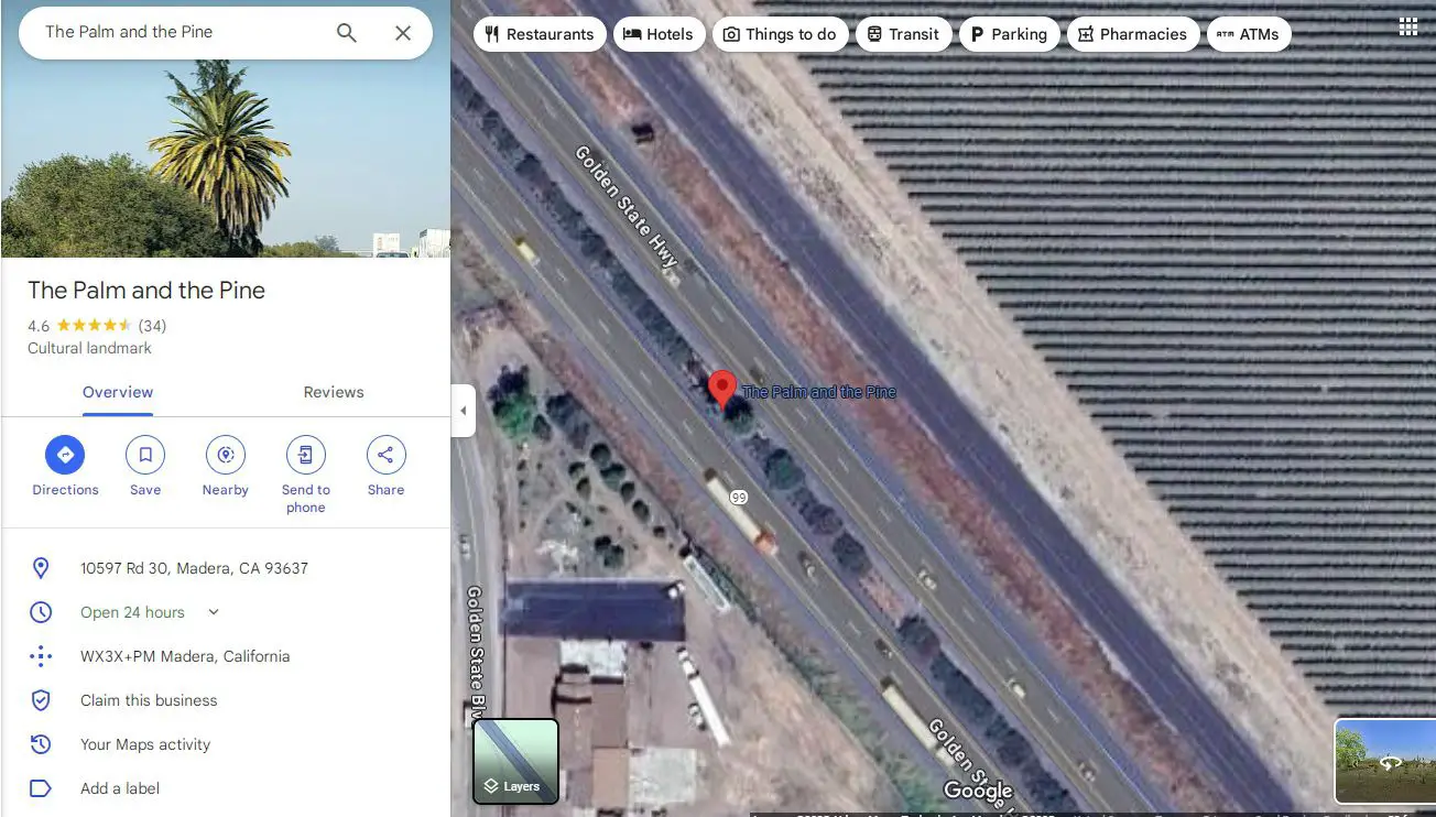
First, here are the official coordinates to put into Google Maps, Apple Maps, or your GPS to begin your up-close trip.
The coordinates for The Palm and the Pine are,
36.904349, -120.000832
If the coordinates aren’t working, simply look up “The Palm and the Pine” on Google or Apple Maps, and it’ll show up as a location.
You can also click here to see the official place on Google Maps.
Slowing down, stopping, and attempting to see The Palm and the Pine from the actual emergency shoulder of Highway 99 is NOT an option.
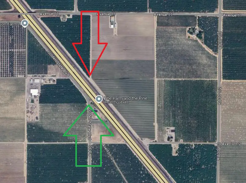
That being said, there’s only one legal way to see The Palm and the Pine off the highway and from a safe location.
You can safely pull off the side of Golden State Blvd 10597 Rd 30 onto the dirt near the orchard and, looking out for traffic both ways, cross Rd 30 to get a closer look of “The Palm and the Pine.”
This option is pointed out by the green arrow below and a street view on Google Maps linked here.
I wouldn’t recommend parking on the grass on the other side as your car’s hot exhaust can set the dry brush on fire.
If you’re hellbent on getting the best and safest view of The Palm and the Pine, it’s from the other side of the highway opposite to Rd 30. I’ve pointed out said place off of Avenue 11 (which is on private property) with a red arrow.
The owner of the dirt road is most likely the farmer who lives closest to it. If you can figure out who that is, perhaps they’ll let you drive down it for that closer look.
As mentioned, the OG Palm and Pine will be removed later in 2025; the best guess is sometime in July 2025, so you only have a few months to see the original.
They will be replaced by 15 palms and 15 pines, supposedly planted and irrigated near where the original pair are.
