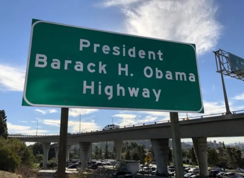
Former President Barack H. Obama now has his own stretch of freeway in California he can call his own.
Whether you like it or not, if you’re going to drive between Pasadena and Glendale on Highway 134, you’re going to drive through a four-mile stretch of road now known as the President Barack H. Obama Highway. If you’re like me and totally want to take a photo with, or at the very least, drive by these signs, here’s how to see them for yourself.
Here’s a birds-eye view of the stretch of freeway that is President Barack H Obama Highway.
According to Anthony J. Portantino,
“The renaming was a result of the passage of SCR 8 authored by Portantino and Congressman Jimmy Gomez. SCR 8 called for the stretch of the CA – 134 freeway between the Glendale CA-2 and the Interstate 210 Freeway to be named the “President Barack H. Obama Highway.”
Now, for the exact locations of the signs themselves. According to a CalTrans spokesperson,
“Two large, green-and-white freeway signs were unveiled Thursday, one on the right shoulder of westbound State Route 134 at the beginning of the 210 Freeway at Fair Oaks Avenue in Pasadena, the other at the eastbound 134 in the vicinity of Route 2 in the city of Los Angeles near Glendale, according to Caltrans spokesman Marc Bischoff.”
The first sign near Pasadena is the one that’s a little hard to get to and I would not recommend going on foot to take a photo of it as you have to cross several rows of moving freeway traffic to get to it. Here’s what it looks like when you drive by it.
And this is what it looks like on Google Maps. Since Google drove by this spot in 2017, the map does not currently show the new Obama Highway sign, but it’s there.
I don’t live in Los Angeles but if I DID want to get the best photo of the Pasadena side sign, you can park near the shopping center where Smart and Final is and can take a photo from the Fair Oaks Avenue overcrossing as shown via Google Maps here.
The second sign near Glendale is a little easier to get to and, if you’re careful, it’s not impossible to hoof it up to the sign for a photo. Here’s what the sign looks like.
And here’s what the sign looks like from the freeway on Google Maps.
If I was going to get to this sign on foot, you can park at this parking station here at 1540 Wilson Ave.
You’ll have to literally cross some freeway exits so you’re going to have to be careful and look out for cars but, as I mentioned, not entirely impossible. It’s probably easier to pull off the freeway where this sign is since there’s a shoulder to drive on for emergency purposes.
So, there you have it. If you want to get up close photos of the Barack Obama Highway signs, that’s how I’d get to both.
Do you have a better way to get to these signs? Let me know in the comments!
Source: Senate.CA.gov


